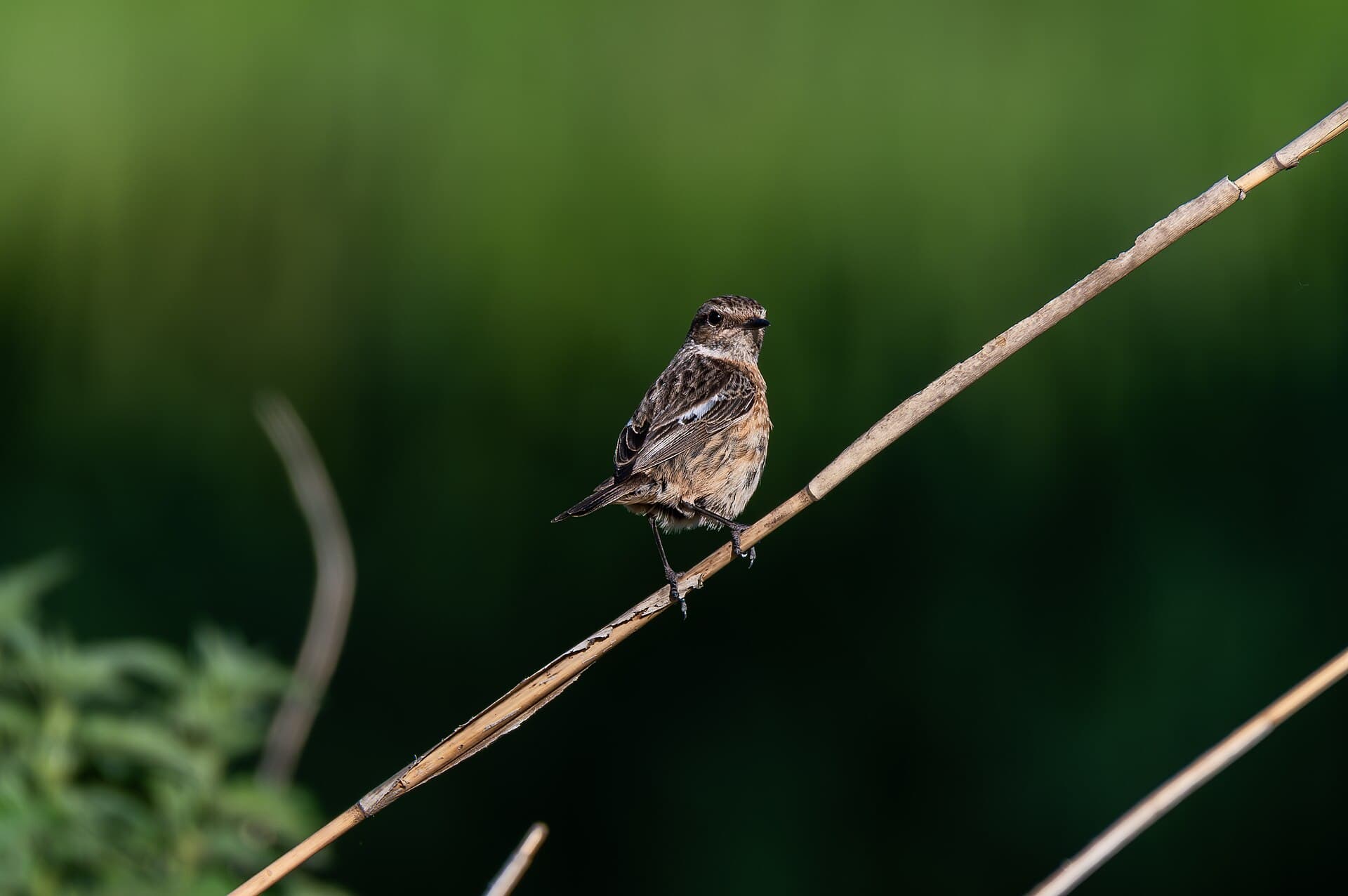
Where to see Whinchat
Saxicola rubetra · Monthly patterns and locations based on open observation data.
- locations with data
- 64
- GBIF counts
- 32,767
- family
- Muscicapidae
The strongest months in the historical data are September, August and May.
Monthly pattern
Monthly totals
Jan
Feb
Mar
Apr
May
Jun
Jul
Aug
Sept
Oct
Nov
Dec
Locations with sufficient data
- Meijendel & BerkheideZuid-Holland2,002 GBIF counts
- WaddenzeeFriesland2,805 GBIF counts
- Kennemerland-ZuidNoord-Holland2,289 GBIF counts
- BiesboschNoord-Brabant2,580 GBIF counts
- RijntakkenGelderland1,690 GBIF counts
- NoordzeekustzoneNoord-Holland4,028 GBIF counts
- VeluweGelderland1,437 GBIF counts
- OostvaardersplassenFlevoland694 GBIF counts
- FochteloërveenDrenthe3,464 GBIF counts
- Vlakte van de RaanZeeland1,715 GBIF counts
- Westerschelde & SaeftingheZeeland1,661 GBIF counts
- Noordhollands DuinreservaatNoord-Holland1,203 GBIF counts
- VoordeltaZeeland923 GBIF counts
- GrevelingenZeeland330 GBIF counts
- OosterscheldeZeeland399 GBIF counts
- Drentsche Aa-gebiedDrenthe350 GBIF counts
- Oostelijke VechtplassenNoord-Holland923 GBIF counts
- DwingelderveldDrenthe293 GBIF counts
- LauwersmeerGroningen429 GBIF counts
- IJsselmeerFriesland263 GBIF counts
- Schoorlse DuinenNoord-Holland399 GBIF counts
- Abtskolk & De PuttenNoord-Holland199 GBIF counts
- MeinwegLimburg243 GBIF counts
- ArkemheenGelderland242 GBIF counts
- Hollands DiepNoord-Brabant291 GBIF counts
- Duinen AmelandFriesland64 GBIF counts
- VeluwerandmerenFlevoland103 GBIF counts
- MarkiezaatNoord-Brabant147 GBIF counts
- Loonse en Drunense Duinen & LeemkuilenNoord-Brabant239 GBIF counts
- Duinen SchiermonnikoogFriesland75 GBIF counts
- Leenderbos, Groote Heide & De PlateauxNoord-Brabant118 GBIF counts
- Duinen VlielandFriesland70 GBIF counts
- Groote PeelNoord-Brabant64 GBIF counts
- Solleveld & KapittelduinenZuid-Holland141 GBIF counts
- Krammer-VolkerakZuid-Holland106 GBIF counts
- Duinen Den Helder-CallantsoogNoord-Holland48 GBIF counts
- LeudalLimburg76 GBIF counts
- Voornes DuinZuid-Holland103 GBIF counts
- Polder ZeevangNoord-Holland49 GBIF counts
- BargerveenDrenthe33 GBIF counts
- Zwanenwater & PettemerduinenNoord-Holland17 GBIF counts
- LeekstermeergebiedDrenthe15 GBIF counts
- Strabrechtse Heide & BeuvenNoord-Brabant23 GBIF counts
- Duinen TerschellingFriesland62 GBIF counts
- Ilperveld, Varkensland, Oostzanerveld & TwiskeNoord-Holland29 GBIF counts
- Vecht- en Beneden-ReggegebiedOverijssel16 GBIF counts
- ZouweboezemUtrecht20 GBIF counts
- MaasduinenLimburg11 GBIF counts
- Duinen en Lage Land TexelNoord-Holland22 GBIF counts
- ZuidlaardermeergebiedGroningen21 GBIF counts
- Buurserzand & HaaksbergerveenOverijssel20 GBIF counts
- Veerse MeerZeeland17 GBIF counts
- Duinen Goeree & Kwade HoekZuid-Holland20 GBIF counts
- Eemmeer & Gooimeer ZuidoeverNoord-Holland12 GBIF counts
- BoschhuizerbergenLimburg7 GBIF counts
- Ketelmeer & VossemeerOverijssel17 GBIF counts
- De WiedenOverijssel6 GBIF counts
- Kop van SchouwenZeeland15 GBIF counts
- NaardermeerNoord-Holland11 GBIF counts
- Kempenland-WestNoord-Brabant10 GBIF counts
- LepelaarplassenFlevoland8 GBIF counts
- Sallandse HeuvelrugOverijssel11 GBIF counts
- AamsveenOverijssel10 GBIF counts
- Oudeland van StrijenZuid-Holland5 GBIF counts
Data source
Counts are aggregated from open observation data supplied through GBIF. They indicate historical reporting patterns, not guaranteed current presence. Last processed: 28 July 2026.